| Home | History | - | By Name | By Forest | By Map | Tours | - | Camera | Finder | Lookout | Documents | QTVR |

Osborne Photo index by forest name.

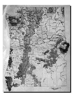
Select a forest from the 1933 USDA Forest Service map of Oregon and Washington above.

USDA Forest Service Region 6 Forests as of 1933 (and 1998).

Washington

Western Oregon

Eastern Oregon

.
Chelan (Okanogan)
.
Mt. Hood
.
Deschutes
.
Colville
.
Rogue River (part of Winema)
.
Fremont (part of Winema)
.
Columbia (Gifford-Pinchot)
.
Siskiyou (part of Six Rivers)
.
Malheur
.
Mt. Baker (Mt. Baker-Snoqualmie)
.
Siuslaw
.
Ochoco
.
Olympic
.
Umpqua
.
Umatilla
.
Snoqualmie (Mt. Baker-Snoqualmie)
.
Willamette
.
Wallowa (Wallowa-Whitman)
.
Wenatchee
.
Whitman (Wallowa-Whitman)

Other Forests, State and Local

Washington

Western Oregon

Eastern Oregon

Department of Natural Resources
.
Clackamas-Marion Fire Protective Agency
Oregon Department of Forestry
.
Tillamook Burn (State of Oregon Forest)
.
Oregon Department of Forestry, Northwest
.
Oregon Department of Forestry, Southwest


| Home | History | - | By Name | By Forest | By Map | Tours | - | Camera | Finder | Lookout | Documents | QTVR |


Copyright 1997-2002 IamWho Panoramic Imaging. Send comments to commentsOPIV2@iamwho.com, Last updated Thursday, September 26, 2002